The Roc de Chère is a mountainous outcrop that juts out into Lake Annecy near the villages of Talloires and Menthon Saint-Bernard on the eastern shore of the lake. It is one of the most important nature reserves in the department. It has a surface area of 69 hectares and culminates at an altitude of 601 metres, plunging steeply into the lake and revealing large cliffs of 50 to 70 metres in height.
How to get to the Roc de Chère?
This natural area is located on the right bank of Lake Annecy in the direction of Veyrier-du-Lac, you then pass Menthon-Saint-Bernard and at the level of Talloires, you turn right when a sign indicates the golf of Talloires. You must then park in the public car park before the golf course.
If you come from the end of the lake from Faverges, you must follow the direction of Doussard and then the road toAngon until Talloires. As you go up the hill, you will turn left at the golf course.
The Roc de Chère hike
The access is made by coming from Annecy, while passing by Menthon-Saint-Bernard. Once past the village, take the small signposted path “Golf du lac d’Annecy” and park in the first car park, the second car park is reserved for golfers.
The walk begins with a panel explaining the interest of the reserve: fauna, flora, geology and history. The different circuits are explained, we recommend the green belvedere circuit which is the most complete. Following the path, you enter the woods by following the signs. At the top, a magnificent viewpoint is offered to you, with a view of the Tournette, the bay of Talloires-Montmin, and the Château de Duingt.
The return journey is via a path that descends. By going straight on at the first crossroads, you will reach another viewpoint where you can admire numerous lizards depending on the season. To return to the car park, follow the green route signs past the golf course. Dogs are allowed if kept on a lead.
Educational video on the Roc de Chère reserve
In 1978, the Roc de Chère site became a nature reserve in order to protect the great wealth of limestone slopes, marshes, central sandstone plateau, depression on limestone and sandy soil or the acidic ridges.
There are no less than 560 varieties of plants and flowers from the Ice Age, the sub-alpine level or the sub-Mediterranean flora. Numerous animals have also taken up residence here, including the magnificent salamander, which was so dear to François I.
This reserve is managed in collaboration with the Talloires golf course. The dry meadows are home to orchids, numerous insects and a wide variety of fossilised shells.
Photos of the Roc de Chère
Information panel at the start of the various walks at the Roc de Chère which guides visitors to the three proposed paths and provides various tips: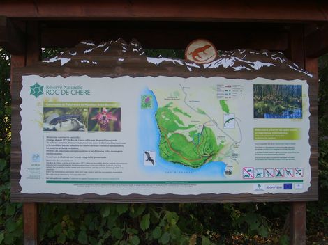 Belvedere path which leads to a magnificent panorama of the lake (visible below):
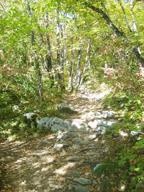 View of the lake accessible by the Belvedere path, this part of the lake is called “The small lake”:
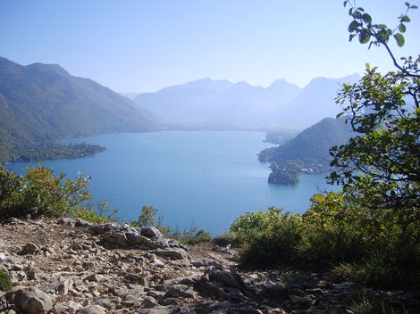 The famous salamander of the Roc de Chère
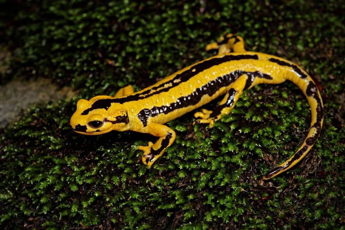
You can also discover the Bout du Lac Nature Reserve, which is located in the commune of Doussard.


