The Bauges massif is made up of 14 mid-mountain villages. Its geographical location places it between Chambéry, Aix-les-Bains, Albertville and Annecy. This massif is a UNESCO World Heritage Site. Discover the true nature of the Savoie region.
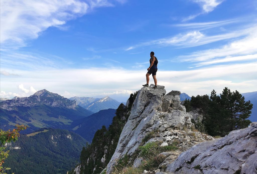
Discover the Massif des Bauges
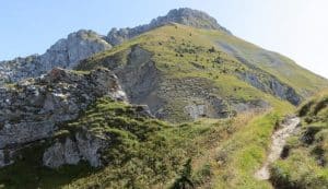
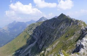
The massif is located on the western shore of Lake Annecy, it measures nearly 800 km² and its highest point, the Arcalod, rises to an altitude of 2,217 metres. The park is crossed by a torrent, “Le Chéran”, which flows into the river Fier that runs through Annecy. This large natural area straddles the departments of Savoie and Haute-Savoie.
It is in these mountain pastures where livestock farming persists that Vacherin cheese and the excellent Tome des Bauges classified as PDO are made. It is therefore a still well-established agricultural activity that you can discover. You can also visit the Tamié abbey which is located in the massif after the town of Faverges and taste the famous cheese of the monks whose taste is close to the reblochon.
The subsoil of the massif is made up of numerous cavities which interest speleologists. For this reason, the Bauges massif has obtained the GeoPark label.
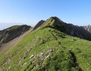
Many forest walks are available, some of them in the form of educational interpretation trails to discover themes such as the different trees in the park. We recommend the following hikes: the Féclaz clearings, the Bellevaux valley and the Revard plateau.
The ski resorts of the Bauges
This large massif has beautiful winter sports resorts such as :
- The Semnoz resort
- The resort of Savoie Grand Revard – La Féclaz
- The resort of Sambuy
- The resort of Aillons Margériaz
These resorts allow you to practice many different sports such as: downhill skiing, Nordic skiing and to go for beautiful snowshoeing trips.
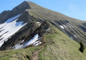
Safety measures: to practice hiking or snowshoeing, it is better never to go alone. The snow sometimes has difficulty clinging to the steepest slopes in the mountains. It is therefore advisable to avoid going out in this type of area because of the risk of avalanches.
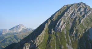
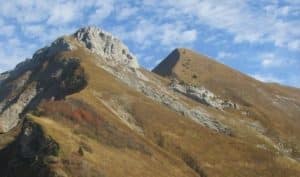
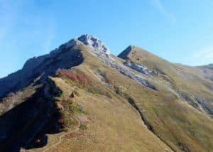
The 14 summits over 2000 metres in the Bauges
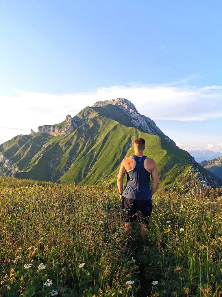
In the Himalayas, there are 14 peaks over 8,000 metres in altitude. Coincidentally, there are exactly 14 peaks over 2,000 metres in the Bauges massif. It is a great challenge for the hiker to try to climb them all, of course not in one single outing. The most experienced hikers will be able to climb several summits in one day.
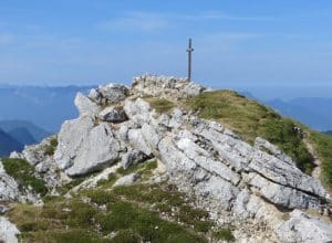
Arcalod
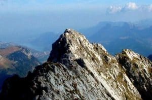 This is the highest point of the Bauges massif at 2,217m. It must be earned with a steep climb from the start car park, a tricky aerial finish which can be slippery on the descent.
Access: Follow École en Bauges on the D60, then head towards Le Carlet. Then you go to the end of the forest road to the Nant Fourchu.
Parking: At the Nant de Fourchu, plenty of places.Difference in altitude: 1,220 mDifficulty: High, you need to be well trained and careful.Duration: 4 hours of climbing
Pointe de la Sambuy
 There are two ways of approaching this summit: either by taking the chairlift from Seythenex which will take you a long way up, or by choosing a long and demanding hike away from the crowds.
Access: Follow École en Bauges by D60 then direction le Carlet. Then you go to the end of the forest road to the Nant Fourchu.
Parking: At the Nant de Fourchu, plenty of places.Difficulty: High with sometimes slippery ground in case of humidity. Ascent: 1 865 mDuration: 4 to 5 hours of climbing
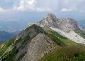
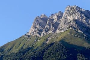
Mont Pecloz
 For some Bauges enthusiasts, Mont Pecloz is the most beautiful summit in the Bauges with its spectacular geological rails, numerous chamois and a unique silhouette.
Access: Follow École en Bauges by D60 then le Carlet, the forest road will lead you to the Bellevaux car park.
Car park: Bellevaux, with plenty of parking spaces.Ascent: 1,330 m.Duration: 4 hours of climbing.Difficulty: High, with a good climb at the end and a very long return.
Mont Trélod
 With its 2,181 metres high, this summit is very famous for its original shape: a perched syncline. It is also easy to access. Victim of its own success, this hike is very popular. You may come across chamois, mouflons and numerous marmots.
Access: Join Doucy-en-Bauges by the D60.
Parking: After the Chef lieu, go to the hamlet of La Chapelle near the church and park in the two bends on the way down.Difference in altitude: 1,250 m and 1,300 if you choose the loop.Difficulty: You have to be very careful when passing under the waterfall between 1,475 and 1,600 m.Duration: The duration is high with 6 to 7 hours.
Pointe de Chaurionde
 In the centre of the Hautes-Bauges reserve, not far from the Col de Tamié, you can choose between three routes to reach the summit.
This magnificent hike allows you to spend the night at the Drison refuge or at Orgeval and then continue on to another Bauges summit.
Access: Follow Ecole en Bauges on the D60 and then head towards Le Carlet. Then you go to the end of the forest road to the Nant Fourchu.
Parking: Numerous places at the Nant Fourchu car parkLevel: 1,220 mDuration: 4 hours of ascentDifficulty High because the hike is long, you must be well trained.
Mont d’Armenaz
 To discover this summit, you have to stay on the hiking trails because the valley is classified as a research area due to the presence of many chamois. In summer, you will again come across heifers in the mountain pastures.
Access: It is done by the col de Frene on the D 911.
Parking: At the level of the pass along the road.Difference in altitude: 1,290 mDuration: count on 3 to 4 hoursDifficulty: accessible to all, taking into account the duration. Important: there is no water point on this route.
Pointe des Arces
 This mountain is little frequented and allows you to discover a magnificent view of the Combe de Savoie in the heart of the nature reserve. Here too you will come across chamois and alpine flora including the famous rhododendrons.
Access: Follow Ecole en Bauges on the D60 and then head towards Le Carlet. Following the forest road, you park at the Bellevaux car park.
Difference in altitude 1,208 mDuration: between 3 and 4 hours of climbingDifficulty: low but quite long. Good shoes are recommended.
Mont de la Coche
 This outing allows you to admire the Mont-Blac and the Arcalod on the left. Numerous mouflons are also to be seen below.
Access: Follow Ecole en Bauges on the D60, then head towards Le Carlet. Then you go to the end of the forest road to the Nant Fourchu.
Parking: At the Nant de Fourchu, plenty of places.Ascent: 1,070 mDuration: 4 hoursDifficulty: Quite hard, you need to be used to hiking and in good physical condition.
Grand Parra
 This is a demanding outing as there is no path, the slope is steep but the reward will be present when crossing to the Pointe des Arlicots.
Access: Ecole en Bauges by the D911, then the D60 in the village. Follow the signs “L’Arculaz” to the car park.
Parking: You can park further up to the chalet du Praz.Difference in altitude: 650 to 1200 m depending on parking.Duration: just under 4 hours in total.Difficulty: high, you must always be careful and have good shoes.
Pointe des Arlicots
 A route suitable for beginners but not very popular, you will discover the Bellevaux chapel by alternating between forest, mountain pasture and ridge line. A real discovery for nature lovers.
Access: Follow Ecole en Bauges on the D60, then head towards Le Carlet. Following the forest road, you park at the Bellevaux car park.
Difference in altitude: 1,192 m.Duration: you have to climb for 3 hours.Difficulty: low, a little slippery in wet weather.
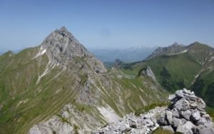
Mont Colombier
 This summit is planted in the middle of the Bauges massif, the panorama allows to encompass the Mont Blanc, the lake of Annec and the Aiguilles d’Arves.
The car park at altitude reduces the difference in altitude. It is an example of a pretty geological znticlinal.
Access: From Chambéry by the D206 or the D59 from Lescheraines, then follow Aillon-le-Jeune, then the D32, at the Correrie turn left on the route de la Fullie until the end of the road at Praz Gelaz.
Parking: in Praz Gelaz limited to 10 places.Level: 850 mDuration: 3 hours of ascent and 2 hours of descentDifficulty: low, beware of slippery ground.
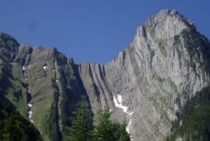
Dent d’Arclusaz
 This is the great mountain of the Bauges for skiing. For hikers, the combe d’Arclusaz formed by an ancient glacier is a wonder.
Access: via the Frene pass on the D 911.
Car park: at the pass.Height difference: 1,090 m.
Duration: 5 to 6 hours for the whole.Difficulty: high the end is done by cables.
Tré le Mollard
 This 2,035m summit is naturally linked to the Mont de la Coche. There is a very nice little corridor to the west.
Access: École en Bauges then Jarsy by the Col du Frêne on the D 911 or by Lescheraines.
Parking: at the hamlet of Coudray, limited to 8 places.
Difference in altitude: 1,115 mDuration: 3 hours for the ascentDifficulty: Average requiring more attention after the Plan de la Limace.
The Encirclement
 This is the last summit on the list that is reached by the Mont de la Cloche. You will have access to an exceptional panorama.Access: go to Jarsy, then to Le Coudray or Précherel.Parking: either at Le Coudray or Précherel.Difference in altitude: 1,000 m.Duration: 3 to 4 hours of climbing.Difficulty: Quite high with a tapered ridge. Here are some suggestions for grouped climbs of the fourteen 2,000 m summits of the Bauges for trained and motivated hikers:
- Mont de la Coche, Encerclement, Tré Le Mollard, Arcalod
- Dent d’Arclusaz, Grand Parra, Pointes des Arlicots
- Pointe des Arces, Mont d’Armenaz, Mont Pecloz
- Pointe de la Sambuy, Pointe de Chaurionde
- Mount Colombier
- Mont Trélod
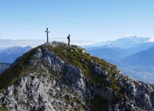
The last record to climb the fourteen 2000 of the Bauges massif is 14 h 26! It is a local sportsman: Aurélien Dunand-Pallaz who set off from his village of Marthod at the foot of the Dent de Cons on Saturday 27th June 2020 at 2:30 am. He improved on the previous record held by François D’Haene in 18 h 21. The journey represents 82 km for 8,800 m of positive altitude difference. In terms of organisation, 25 people were present at each point.
Welcome to the restricted club of “summiters” in the Bauges!


